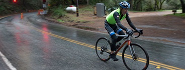
San Pablo Avenue, Albany
San Francisco-Oakland Bay Bridge East Span Bike Path
Napa Valley Vine Trail
Thank you to those who attended one of our final round of community workshops earlier this month. Workshop material can be found below under Documents tab. If you were unable to attend in person, please join our webinar:
Webinar
Thursday, November 30, 2017
1-3pm Click here to join.
The webinar will provide an overview of proposed priority bicycle improvements for the Plan and opportunities for public comments on draft priorities.
In Spring 2017, Caltrans conducted an online survey to collect public input on bicycling needs, issues, and recommendations for the State-owned transportation network across the Bay Area. A total of 4,721 people visited the survey and placed a total of 20,157 “pins” on the map. The survey data will help inform the District 4 Bicycle Plan and is available for download under Documents and Links.
Read the Summary of Survey Results (PDF)
The first round of community workshops was completed in May. Thank you to those who attended and provided feedback. Links to Round 1 community outreach material are provided below under Documents.
This map is an interactive tool to view the needs analysis and priority improvements identified in the Plan. The needs analysis is based on multiple data sources to rank highway segments on Level of Traffic Stress (LTS), low stress connectivity (permeability), collision history, and potential bicycling demand. Improvements are classified by prioritization categories of: top tier, mid tier, and low tier. More information on the needs analysis and improvement prioritization is available in the Documents section.
The planning process for the Caltrans District 4 Bike Plan was informed by input from stakeholders and the public. Key tasks included:
Questions or comments? Contact Sergio Ruiz, Caltrans District 4 Pedestrian and Bicycle Coordinator